ไฟล์:Venezuela - Zulia - Maracaibo.svg

ดูภาพที่มีความละเอียดสูงกว่า ((ไฟล์ SVG, 512 × 684 พิกเซล, ขนาดไฟล์: 2.94 เมกะไบต์))
| รูปภาพหรือไฟล์เสียงนี้ ต้นฉบับอยู่ที่ คอมมอนส์ รายละเอียดด้านล่าง เป็นข้อความที่แสดงผลจาก ไฟล์ต้นฉบับในคอมมอนส์
|
เนื้อหา
ความย่อ
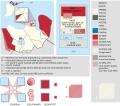
![]() This SVG map is part of a locator map series applying the widespread location map scheme. Please see root category to browse for more.
This SVG map is part of a locator map series applying the widespread location map scheme. Please see root category to browse for more.
Locator maps design recommendations ▼ | |
|---|---|
Principles
Design Guidelines are based on ▸location map design of the German map shop (in German). It's preferable to derive new locator maps from existing location maps. Please keep both size and ratio in this case. Thus the new locator maps may still be applied as location map (▸Guide). Marker color is supposed to be darkred. Waterbodies may be transparent, to show other objects better. Please be aware that this guide is only a recommendation. It’s not an inevitable law!
Highlight small areas
“Remote” areas and mini maps
Mini maps show where the depicted area actually is situated. Check out ▸Vorlage:Positionskarte+ (in German) and ▸Modèle:Carte en coin (in French) of how to insert a mini map in virtually every map.
Disputed areas
Greyed special objects
Backgrounds
|
Map legend
- C12836 → Marked administrative territory
- FDFBEA → Marked state/province
- F6E1B9 → Other state/provinces of Venezuela
- DFDFDF → Other countries
- 656564 → Lines/boundaries
- C6AF8B → Urban areas (25% transparency)
- C7E7FB → Water bodies and sea
- 1278AB → Coastline and water bodies border
Mini map legend
- C12836 → Marked state/province
- FDFBEA → Rest of Venezuela
- DFDFDF → Other countries
- 656564 → Lines/boundaries
- C7E7FB → Water
- 000000 → Mini map border box
Geographic limits of the map (EPSG:4326)
- N: 12.2173
- S: 8.0935
- W: 73.5720
- E: 70.4371
การอนุญาตใช้สิทธิ
| คำอธิบายVenezuela - Zulia - Maracaibo.svg |
English: Locator map of Municipio Maracaibo; in Zulia, Venezuela |
|||||||||
| SVG genesis InfoField | ซอร์สโค้ดของ SVG นี้ตรวจสอบถูกต้องแล้ว ไฟล์ภาพกราฟิกส์เวกเตอร์นี้ สร้างขึ้นโดยใช้ Adobe Illustrator |
|||||||||
| วันที่ | ||||||||||
| แหล่งที่มา | OpenStreetMap data, extracted via QGIS software. | |||||||||
| ผู้สร้าง |
OpenStreetMap contributors |
|||||||||
| การอนุญาต (การใช้ไฟล์นี้ใหม่) |
OpenStreetMap data is available under the Open Database License (details). Standard style map tiles are licensed as ODbL Produced Works.
|
|||||||||
| Geotemporal data | ||||||||||
| ขอบเขต |
|
|||||||||
| Boundaries geometry from OpenStreetMap has been simplified to optimize its indexing in Wikimedia projects. The boundaries lines shown in this image may be of lower quality than those shown in OpenStreetMap project, or in real life. |
คำบรรยายโดยย่อ
รายการที่แสดงอยู่ในไฟล์นี้
ประกอบด้วย
บางค่าที่ไม่มีรายการวิกิสนเทศ
15 สิงหาคม 2017
ประวัติไฟล์
คลิกวันที่/เวลาเพื่อดูไฟล์ที่ปรากฏในขณะนั้น
| วันที่/เวลา | รูปย่อ | ขนาด | ผู้ใช้ | ความเห็น | |
|---|---|---|---|---|---|
| ปัจจุบัน | 19:41, 30 กันยายน 2566 |  | 512 × 684 (2.94 เมกะไบต์) | Wguayana | OpenStreetMap 2023 data |
| 04:56, 16 สิงหาคม 2560 |  | 1,754 × 2,231 (614 กิโลไบต์) | Milenioscuro | User created page with UploadWizard |
หน้าที่มีภาพนี้
หน้าต่อไปนี้ โยงมาที่ภาพนี้:
การใช้ไฟล์ข้ามโครงการ
วิกิอื่นต่อไปนี้ใช้ไฟล์นี้:
- การใช้บน eo.wiki.x.io
- การใช้บน es.wiki.x.io
- การใช้บน eu.wiki.x.io
- การใช้บน fr.wiki.x.io
- การใช้บน hr.wiki.x.io
- การใช้บน it.wiki.x.io
- การใช้บน ja.wiki.x.io
- การใช้บน lad.wiki.x.io
- การใช้บน mdf.wiki.x.io
- การใช้บน nl.wiki.x.io
- การใช้บน nn.wiki.x.io
- การใช้บน pt.wiki.x.io
- การใช้บน uk.wiki.x.io
- การใช้บน war.wiki.x.io
- การใช้บน www.wikidata.org
- การใช้บน zh.wiki.x.io
ข้อมูลเกี่ยวกับภาพ
ภาพนี้มีข้อมูลเพิ่มเติม ซึ่งส่วนใหญ่มาจากกล้องดิจิตอลหรือสแกนเนอร์ที่สามารถเก็บข้อมูลดังกล่าวไว้รวมกับภาพได้ ถ้าภาพนี้ถูกปรับปรุงแก้ไขหรือเปลี่ยนแปลงจากเดิม ข้อมูลบางอย่างจะยังคงไม่เปลี่ยนแปลงเหมือนภาพที่ถูกปรับปรุงแก้ไขนั้น
| ชื่อเรื่องสั้น | Municipio Maracaibo - Zulia - Venezuela |
|---|---|
| ความกว้าง | 100% |
| ความสูง | 100% |


